|
Bures-online.co.uk |
|
 |
|
|
||||
|
Local
Information
|

|
BURES is located on the border between South Suffolk and North Essex, in the heart of picturesque `Constable` country and in an Area of Outstanding Natural Beauty(AONB)
|
|
With one half in Suffolk
and the other in Essex, the village is served by two county councils,
three district (Colchester/Braintree/Babergh) councils, two Members of
Parliament and two Education Authorities (Essex/Suffolk). One of our oldest buildings
is St Stephens Chapel which dates
back to 1218 when it was dedicated by the Archbishop of Canterbury. It
predates St Mary`s Church in the village centre, by some 150 years. In 1659 the village was also known as "Bewers" before it gained its modern title of Bures. During the Victorian era, Bures was
an Industrial village, completely self sufficient. Before the coming of the railway in
1849 the transportation of heavy goods manufactured in the village, such
as bricks and malt were undertaken by barge (lighter) along the River
Stour down to Mistley. This was immortalised by the paintings of John
Constable with his portraits of Flatford Dry Dock and the White Horse
etc Unfortunately, even the railway wasn`t safe, the transportation of goods collapsed as they were diverted away too road haulage and Dr Beechings axe fell during the 1960`s. Fortunately for us, the section between Sudbury, Bures and Marks Tey was left intact, where today it links up with the main line inter-city services to London, Liverpool Street. Like all villages, we have seen considerable change since those days. Today every plot of land is being developed to satisfy the incoming commuting public. One positive effect has seen the railway line rapidly grow in passenger numbers, which has resulted in millions being spent on upgrading the rail track as well as the introduction of modern rolling stock. We can offer two Nature Reserves, Arger Fen a Site of Special Scientific Interest (SSSI) and the adjacent Spouses Vale owned by the Suffolk Wildlife Trust. Back in the 1950`s we boasted something
like 50 retailers within the two parishes, which included the pubs, a
Co-op store, Barclays Bank, Blacksmiths and a multitude of small shops
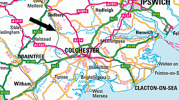
providing everything you could possibly require without leaving the village. Road Mileage - Colchester (10m) Sudbury (5m) Bury St Edmunds (20m) Ipswich (23m) Long Melford(8m) Lavenham (12m) Public transport is provided by Chambers Coaches which run a daily service between Colchester - Bures - Sudbury - Lavenham - Bury St Edmunds. Chambers have a fleet of coaches/buses which are based in the village at their head office and workshop.
The centre of the village has many old historic buildings, some dating from the 16th and 17th century. Currently we have registered 75 listed buildings. The population of Bures (2001 census) numbers around 1800, with 659 in Bures Hamlet and 728 in Bures St Mary. In the Doomsday records,
the village is referred to as "Bura" or "Bure", it`s
documented having a church with 18 acres of free land. The name "Bures"
could be derived from either an Old English word "bur", meaning
a cottage or bower, or from a Celtic word meaning a "boundary",
The village hosts
many activities throughout the year:-
25.05.09 |