|
Arger Fen is split in two by an old
earth bank which is the parish boundary. To the east was Wiston Prestney
Grove, in the Middle ages this was used as arable and pasture land. After
the Black death in 1348/9 the farmland was abandoned and regenerated to
forest.
In Medieval times tenants collected firewood and workmen dug out clay
in the woods. Remnants of these pits can still be seen. The clay was used
to line the timber-framed houses of that period, timber was also felled
for housing.
You will se plenty of these pits, ponds and dells as well as some evidence
of a brick making facility.
The parish boundary between Assington and Bures runs through the centre
of this wood.
In the 1960s, the Forestry Commission
planted conifer trees, such as Corsican Pine.
Unfortunately, these killed off the natural undergrowth and left a dense
layer of dry dead conifer matting. These are gradually being harvested
and replaced with broad leafed trees. This is now allowing the wild plants
to return.
Visit the wood on a July evening and
you will most probably see Glow Worms. Throughout the summer, butterflies
in large numbers are attracted by the wild flowers.
Arger Fen`s birdlife include the Goldcrest, Nuthatch, Treecreeper and
Woodcock. Other occasional visitors include the Grasshopper Warbler, Nightingale
and Hawfinch.
Location:-Ordnance
Survey map reference TL930353
Walks: 1 mile or circular walk
2� miles
Conditions: Woodland and field
edge paths, pasture and road, 3 stiles
Access: This site is not suitable for wheelchair
access.
Managed by:- Suffolk
Wildlife Trust
Car Parking: Gravel area beside roadway.
Non secure area. Lock Cars.
How to get there:-
By Foot:-
By Road: Take the Nayland Rd out of Bures,
into the open countryside.
Approximately 1.5miles out
of the village you will arrive at a crossroads.
Signposted Right for Smallbridge Hall
and Wormingford
Signposted Left for "Churchs Seed Store" and Arger Fen
Turn left, up a narrow winding road,
past the Seed Store and then you will find a car park outside the wood
on the right.
 |
 |
|
Entrance to
Wood
|
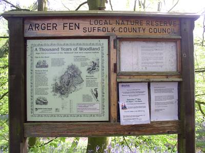
Notice Board
|
 |
Butterflies can be
seen along the main path on sunny summer days and a variety of birds
and small mammals frequent the woods throughout the year.
Look out for the
woodpeckers, wrens and goldcrests among the trees.
|
|
Ford across the
access road, leading to Arger Fen
|
 |
 |
|
Late Spring,
the wood turns into a sea of colour as bluebells carpet the entire
area. The scent is quite pronounced and the view magnificent.
|
 |
 |
|
Follow the seasons
by watching the changes in the wild cherry trees.
In the spring the trees
are dusted with white blossom, with their leaves turning to red
and yellow with the arrival of autumn. On a good year the trees
are laden with berries which is ideal food for the birds.
|
 |
 |
|
In drier parts
of the wood there are hazel, ash and oak trees and elsewhere, wild
cherry trees and some rarer small-leaved lime trees. At the bottom
of the valley where the soil is wetter and marshy, wild garlic grows
in the shade of willow and alder trees.
|
|
|
Historical Information
The name Arger Fen has possibly
two derivations:-
(a) "Arger or Agger" meaning earth rampart or bank, possibly
roman, earthwork, a mound or raised work.
(b) "Arger" came from the Old English word for Hanging
wood.
(c)"Fen" meaning boggy, wet, marshland.
Top left of the map, from Gt Waldingfield
there is a roman road running south through Newton.
If you project this road (blue line) it runs directly through Arger
Fen.
Project this line even further
south into Essex and the road terminates at the roman earth works
(Tumulus) at Lexden, Colchester.
Project this line northwards and it terminates at Bury St Edmunds.
Has this any bearing on the
History of Arger Fen, I have no idea.
Perhaps it`s coincidence ?
|
Acknowledgement to Suffolk
County Council, Countryside Service for the text.
Suffolk County Council Web site see:- www.suffolkcc.gov.uk/e-and-t/countryside
Photos by Alan Beales.
update 20/01/2019
|